
















A great outdoor ride does not start with a beautiful photo. For riders, the real question is not only where the trail is, but whether the route fits your skill level, bike setup, time, and riding goals.
This guide highlights five scenic bike trails in the U.S. that offer different outdoor riding experiences, from desert backcountry routes to long-distance touring, lake views, red rock terrain, and canyon scenery.
Quick Comparison of the 5 Trails
|
Trail |
State |
Approx. Distance |
Trail Type |
Difficulty |
Best For |
|
Black Canyon Trail |
Arizona |
80 miles |
Desert backcountry trail |
Hard |
Experienced riders |
|
Ohio to Erie Trail |
Ohio |
326 miles |
Long-distance multi-use trail |
Easy to moderate by section |
Long-distance riders and weekend touring |
|
Lake Ouachita Vista Trail |
Arkansas |
38.3 miles |
Lake-and-forest singletrack |
Varies by section |
Longer scenic rides |
|
Gooseberry Mesa & Hurricane Cliffs |
Utah |
13.1-mile Big Loop; nearly 40 miles in Hurricane Cliffs |
Technical red rock trails |
Intermediate to advanced |
Experienced mountain bikers |
|
Spearfish Canyon |
South Dakota |
6 to 7.2 miles by route |
Canyon and forest route |
Easy to moderate |
Scenic riders |
Black Canyon Trail, Arizona
Black Canyon Trail is one of Arizona’s most iconic desert riding routes. This 80-mile trail runs through the Sonoran Desert, where riders can experience cactus-covered landscapes, rugged canyons, rocky terrain, dry washes, and wide-open views of the American Southwest.
This is not a casual city park route or a simple paved bike path. Black Canyon Trail has a true backcountry feel, with limited shade, rough surfaces, rocky sections, elevation changes, and long stretches that require careful planning. The scenery is impressive, but the difficulty should be taken seriously.
This trail is best suited for experienced mountain bikers who are comfortable with desert conditions and longer-distance route planning. Riders who usually stay on city streets, paved greenways, or short recreational paths should build confidence on easier trails before attempting longer sections here.
Before riding, bring plenty of water, sun protection, navigation tools, and basic repair gear. Riders should also check trailhead spacing, return options, seasonal heat, and trail conditions. If e-bikes are allowed on your chosen section, a fat tire or all-terrain e-bike can offer better traction and stability than a standard city bike, but range planning is just as important as motor power.

Ohio to Erie Trail, Ohio
Ohio to Erie Trail is a long-distance multi-use route that crosses Ohio from Cincinnati to Cleveland. At about 326 miles, it is not a route most riders complete in one day. Instead, it is best planned by section, making it a strong choice for weekend trips, multi-day rides, and riders who want to build confidence on longer routes.
The trail connects regional parks, small towns, rural areas, canal paths, rail trails, and urban sections. Surface conditions can vary, including paved trail, crushed stone, road segments, and street sections. That variety makes route planning important, especially for riders who want a smooth and comfortable experience.
Compared with technical mountain bike trails, Ohio to Erie Trail is more approachable. The challenge comes less from difficult terrain and more from distance, pacing, weather, and logistics. Riders should plan around daily mileage, rest stops, water, food, lodging, parking, and return transportation.
This route is a good fit for riders who enjoy steady scenic riding, long-distance touring, and flexible weekend travel. For e-bike riders, it is especially important to check local rules by section, because long multi-use routes can pass through different cities, counties, parks, and trail managers.
For this kind of long-distance route, comfort matters as much as performance. A relaxed riding position, reliable brakes, efficient tires, enough battery range, and space for water, snacks, tools, and extra layers can make the ride much smoother.

Lake Ouachita Vista Trail, Arkansas
Lake Ouachita Vista Trail, often called LOViT, is a 38.3-mile singletrack route that combines lake views with forest riding. It runs through the Lake Ouachita and Ouachita National Forest area, making it a strong choice for riders who enjoy wooded terrain, open lake scenery, and longer outdoor routes.
The appeal of LOViT comes from its variety. It is not just a forest trail, and it is not simply a road beside the water. Riders may pass through quiet wooded sections, rolling terrain, natural-surface trail, and singletrack while also reaching open views of Lake Ouachita.
The difficulty depends on the section, so this trail can range from beginner-friendly to more challenging. For a first visit, it is better to choose a manageable section with a clear trailhead, reasonable distance, and simple return route instead of trying to ride the entire trail at once.
LOViT is a good example of why map planning matters. Do not focus only on the total trail length. Check the section you want to ride, parking areas, restrooms, viewpoints, water access, and possible exit points. Cell service may be limited in wooded or lakeside areas, so downloading an offline map is highly recommended.
For this type of route, range, comfort, and stability become more important than speed. A bike that handles mixed surfaces well can make the ride feel smoother and more controlled, especially on longer scenic sections.

Gooseberry Mesa and Hurricane Cliffs Trails, Utah
Gooseberry Mesa and Hurricane Cliffs in southern Utah are among the most recognizable red rock riding destinations in the U.S. With slickrock, singletrack, desert mesa views, rocky trail lines, and exposed terrain, this area is a bucket-list ride for many mountain bikers.
The scenery is dramatic and unforgettable. Red rock formations, wide-open desert views, technical features, and high mesa terrain create a very different experience from forest or lake riding. This is not a relaxed sightseeing path. It feels like a true technical mountain biking destination.
Because of the terrain, this area is not ideal for complete beginners. Red rock routes require route awareness, braking control, bike handling skills, and physical fitness. Riders who are not familiar with slickrock should start with shorter and easier sections before attempting longer or more technical routes.
Planning is especially important here because Gooseberry Mesa and Hurricane Cliffs are related riding areas, but they are not one simple trail. Choose your riding area first, then check the trailhead, loop options, parking, access road conditions, water needs, and weather. Heavy rain can make access roads difficult or unsafe.
Whether you ride a traditional mountain bike or an e-bike, safety and control matter more than raw power. If e-bikes are allowed on your chosen route, pay attention to braking, tire grip, stability, and handling. On technical terrain, the real question is not whether the bike is powerful enough, but whether you can control it safely.

Spearfish Canyon, South Dakota
Spearfish Canyon, located in the Black Hills National Forest area of South Dakota, is a great choice for riders who care about scenery as much as the ride itself. The area is known for canyon views, limestone cliffs, pine forests, aspen trees, and beautiful fall colors.
Compared with technical destinations such as Gooseberry Mesa, Spearfish Canyon is more approachable. Riders can focus on routes such as Little Spearfish Trail, a 6-mile loop, or Rimrock Trail, a 7.2-mile route accessible from the Little Spearfish trailhead.
This area is generally easy to moderate, making it a good fit for beginner to intermediate riders. It is especially suitable for riders who enjoy canyon scenery, forest routes, fall color, and a more comfortable pace.
When planning your ride, choose a route that matches your time and fitness level. Beginners should start with a shorter loop that is easy to follow. Weather can change quickly in canyon and forest areas, especially in the fall, so bringing an extra layer is a smart choice.
For a scenic route like this, comfort matters more than extreme performance. A relaxed riding position, stable braking, smooth assistance, and a bike setup suited for longer rides can help you focus more on the views and less on fatigue.

Pre-Ride Gear Checklist
The right gear depends on the route, weather, surface type, and riding distance, but every outdoor ride should start with a basic safety setup.
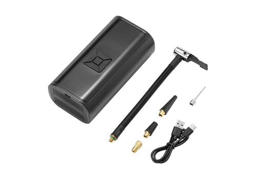
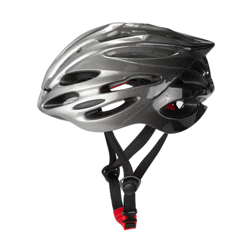
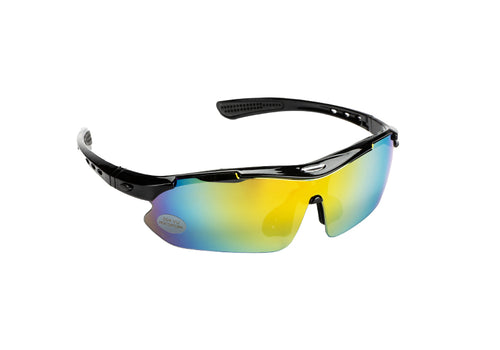
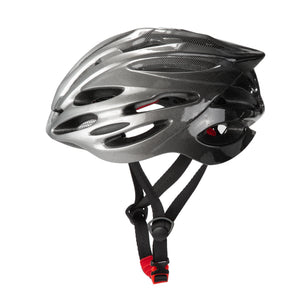
For all rides, bring a helmet, gloves, eye protection, a fully charged phone, an offline map, water, snacks, a small first-aid kit, tire repair tools, a spare tube or patch kit, a mini pump or CO2 inflator, and a multi-tool. These items are especially important on natural-surface trails where help may not be close by.
For desert routes like Black Canyon Trail or Gooseberry Mesa, add extra water, electrolyte tablets, sunscreen, sun sleeves, and lightweight layers. Desert terrain can have limited shade, loose surfaces, and long gaps between support points, so preparation matters more than speed.
For forest and lake routes like LOViT, bring a light rain shell, bug protection, and a bike setup that can handle dirt, roots, rocks, and changing trail conditions. After rain, trails may be muddy or temporarily closed, so always check trail status before riding.
For longer scenic routes like Ohio to Erie Trail, pay close attention to range, comfort, and carrying capacity. Plan your daily mileage, charging strategy, water stops, food options, and return transportation before you ride. If you use an e-bike, start with a full battery, understand your assist levels, and avoid planning a route that pushes your battery to the limit.
Most importantly, check local rules before riding. Not every trail allows e-bikes, and some routes may restrict certain bike classes or motorized equipment. Riding legally and responsibly protects both riders and the trail.

Match Your Bike to the Trail Type
A map can show you where the trail is, but the right bike determines how comfortable and confident the ride feels.
For city-adjacent routes, park paths, paved sections, and short recreational rides, comfort, easy handling, and a relaxed riding position matter most. A commuter e-bike, step-through e-bike, or comfort e-bike is often a good fit.
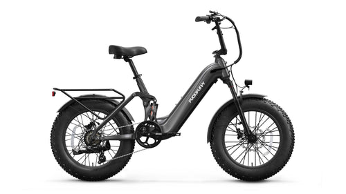
For forest trails, lake routes, gravel paths, or light off-road terrain, stability, tire grip, and reliable braking become more important. A fat tire e-bike or all-terrain e-bike can help riders feel more secure on uneven surfaces.
For longer scenic rides, range and comfort are key. For camping, cargo, pet-friendly outings, or riding around campgrounds and lake areas, a cargo e-bike or e-trike can also be useful in the right setting.
Puckipuppy offers e-bikes for different riding styles, from commuter and step-through models for city and weekend rides to fat tire and all-terrain options for light outdoor exploration, as well as e-trikes for riders who need more stability and carrying capacity.
Before riding any e-bike on a trail, always check local rules first. Riding legally and responsibly is the foundation of every good outdoor adventure.
The Best Trail Is the One You Are Prepared For
The best bike trail is not always the most famous or the most difficult one. It should match your experience, fitness level, gear, available time, and the conditions on the day of your ride.
Before you head out, read the map, check local rules, inspect your gear, and choose the right bike. Good preparation can make your ride safer, smoother, and more enjoyable.
Choose a Puckipuppy e-bike that fits your riding style, and get ready to explore some of the best bike trails in the U.S. with more comfort, freedom, and confidence.
🚲 Choose a Puckipuppy e-bike that fits your riding style, and head out to explore some of the best bike trails in the U.S. with more freedom and confidence.