














E-bikes can make it easier to move between a campground, parking area, and hunting location, especially when the route includes long forest roads, rolling hills, or heavy outdoor gear. However, public hunting land is not automatically open to e-bikes.
E-bike access must be checked separately from hunting access. Use the state wildlife map to confirm the legal hunting unit and public-land boundary, then use the current Motor Vehicle Use Map, or MVUM, or another official travel-management map to identify roads open to the applicable vehicle type.
A dirt road, visible tire track, or route shown on a general navigation map does not confirm legal motorized access. Plan the complete outbound and return distance using a conservative real-world range estimate. When the legal motorized route ends, park the e-bike outside the restricted area and continue on foot only where hunting access is allowed.
The U.S. Forest Service considers e-bikes motorized vehicles. On Forest Service land, they are generally limited to roads and trails designated for motorized use unless a local unit has issued a separate designation. The MVUM also shows vehicle categories and seasonal access restrictions that may apply to individual routes.
Legal Notice: Hunting, public-land access, and e-bike rules vary by location and may change; always verify current requirements with the relevant wildlife and land-management authorities before your trip.

Which Hunting Destination Fits Your Trip?
|
Destination |
State |
Representative Game |
E-Bike Access |
Best For |
|
Black Hills National Forest |
South Dakota and Wyoming |
Deer, Merriam’s turkey, ruffed grouse, unit-dependent elk opportunities |
Open motorized Forest Service roads and designated OHV routes |
Forest hunting, gear transport, multi-day camping |
|
Black Kettle WMA |
Oklahoma |
White-tailed deer, Rio Grande wild turkey, bobwhite quail, rabbit |
Forest Service roads open to the applicable vehicle type |
Grassland hunting and travel between scattered units |
|
White Rock WMA |
Arkansas |
Deer, wild turkey, black bear, squirrel, furbearers |
Open county roads and Forest Service roads |
Hilly, forested, and mountainous hunting |
|
Little Missouri National Grassland |
North Dakota |
Mule deer, white-tailed deer, and other unit-dependent opportunities |
Roads designated for motorized use on current travel maps |
Remote public land and longer access routes |
Seasons, licenses, lotteries, weapon restrictions, bag limits, and nonresident rules change by state and hunting unit. Use the table to compare destinations, then verify the current regulations before making reservations or selecting a route.
Which Maps Should You Check?
Two different maps are often needed because they answer two different questions.
A state hunting map or wildlife agency map helps confirm:
- The legal hunting unit
- Public- and private-land boundaries
- Species-specific zones
- WMA boundaries
- No-hunting areas
- Parking and access points
The current MVUM or official travel-management map helps confirm:
- Roads open to motorized vehicles
- Permitted vehicle categories
- Seasonal route restrictions
- Special-use designations
- Roads closed to public motorized travel
The MVUM is a legal access map rather than a detailed topographic map. Use it with a state hunting atlas, georeferenced WMA map, Forest Visitor Map, or downloaded offline map.
Before finalizing a trip, confirm the selected hunting unit on the state wildlife map and verify the connecting motorized road on the current MVUM or destination-specific travel map.

Black Hills National Forest: Best for Forest Hunting and Multi-Day Camping
Black Hills National Forest extends across western South Dakota and northeastern Wyoming. Its large forest-road network makes it one of the more practical choices for hunters who want to establish a campground as a base and use legal motorized routes to reduce the distance they need to cover on foot.
The Black Hills provides more than 3,800 miles of roads and trails for motorized vehicles. More than 700 miles are designated as OHV system trails and require a valid Motorized Trail Permit.
What Can You Hunt?
Representative game in the Black Hills includes:
- White-tailed deer
- Mule deer
- Merriam’s turkey
- Ruffed grouse
- Elk in applicable units
Hunting rules are not the same on both sides of the forest. South Dakota and Wyoming maintain separate licenses, season dates, hunting units, drawing systems, and nonresident requirements.
Game species documented in the Northern Hills include white-tailed deer, mule deer, elk, Merriam’s turkey, and ruffed grouse.
Choose the state and hunting unit first. After that, identify a campground or legal parking area and look for a connecting Forest Service road shown as open to the correct vehicle type.
Black Hills Access Rules to Check
Black Hills has several location-specific considerations:
- Designated OHV trails may require a Motorized Trail Permit.
- Some routes distinguish between highway-legal and unlicensed vehicles.
- Many OHV routes have seasonal opening and closing dates.
- South Dakota and Wyoming rules differ across the state boundary.
- Black Elk Wilderness is closed to bicycles and motorized travel.
- Temporary closures may be issued for fire danger, construction, weather, or resource protection.
Do not use a general recreation map to determine vehicle eligibility. Check the MVUM legend, the Black Hills OHV map, and the current permit information for the exact route.
Camping and Route Conditions
Black Hills National Forest includes campgrounds, trailheads, parking areas, reservoirs, and dispersed recreation sites. This makes it easier to plan a multi-day hunt from one central location.
Before selecting a campground, confirm:
- Seasonal operating dates
- Reservation requirements
- Water and restroom availability
- Trailer or RV access
- Distance to the selected hunting unit
- Whether a legal motorized road connects the two locations
Forest roads may include packed dirt, loose gravel, shallow ruts, exposed roots, and repeated curves. A loaded bike can also be harder to control on long descents.
For this destination, prioritize stable tires, controlled braking, suspension, and secure gear storage. Maximum speed is less important than predictable handling on gravel and downhill sections.
Best for: Hunters who want an established forest-road network, multi-day camping, and easier equipment transport between camp and a legal hunting unit.

Black Kettle WMA: Best for Deer, Turkey, and Grassland Hunting
Black Kettle Wildlife Management Area is located near Cheyenne, Oklahoma. It covers approximately 30,710 acres and is divided into about 100 separate public-land units.
The landscape includes mixed-grass prairie, rolling sand hills, red shale hills, and wooded bottoms. Because the units are scattered, hunters may need to travel between a campground, parking location, and selected hunting unit.
What Can You Hunt?
Representative game includes:
- White-tailed deer
- Rio Grande wild turkey
- Bobwhite quail
- Cottontail rabbit
- Occasional jackrabbit
- Coyote, bobcat, and raccoon
- Dove during migration periods
Some Black Kettle seasons have area-specific dates, weapon restrictions, hunting-hour limits, or nonresident rules. Use the current Oklahoma hunting regulations rather than relying on dates from an older article or forum post.
Black Kettle Access Rules to Check
Black Kettle National Grassland is managed by the U.S. Forest Service, while the Oklahoma Department of Wildlife Conservation provides WMA hunting information.
The WMA map identifies the public hunting units. Forest Service travel information determines which roads are open to motorized use.
The most important local issues are:
- The hunting units are separated rather than forming one continuous block.
- A road between two units may cross private or non-hunting land.
- OHV access is managed under Forest Service rules.
- Nonresidents should check current public-area check-in and check-out requirements.
- Three developed recreation areas are closed to hunting.
The no-hunting recreation areas are:
- Skipout Recreation Area
- Spring Creek Recreation Area
- Black Kettle Recreation Area
These locations may be useful for camping or resting, but they should not be treated as part of the legal hunting area.
Camping and Route Conditions
Primitive camping is allowed under applicable Forest Service rules. Developed camping is available at Skipout, Spring Creek, and Black Kettle recreation areas, although the official WMA information notes that RV hookups are not available. Lodging and food can be found in Cheyenne.
A practical planning order is:
- Select the legal WMA unit.
- Locate the nearest legal parking area or campground.
- Identify the connecting road on the current Forest Service travel map.
- Remove the three no-hunting recreation areas from the route.
- Check whether private land separates the road from the hunting unit.
In dry weather, riders can expect grass, dirt roads, and firm prairie surfaces. Rain can quickly create wet grass, shallow mud, and soft soil.
Controlled low-speed assistance and reliable tire grip are more useful here than aggressive acceleration. Stop riding if the tires begin to sink deeply or create damaging ruts.
Best for: Hunters targeting white-tailed deer, Rio Grande wild turkey, bobwhite quail, or rabbit who are comfortable navigating multiple scattered public-land units.

White Rock WMA: Best for Hilly and Mountainous Hunting
White Rock Wildlife Management Area is located in the Boston Mountains of northwestern Arkansas. The Arkansas Game and Fish Commission lists the WMA at 328,836 acres.
The terrain includes deep hollows, steep benched ridges, exposed bluffs, hardwood forest, and pine-covered slopes. Of the four destinations in this guide, White Rock presents the most sustained climbing and descending.
What Can You Hunt?
Public hunting and trapping opportunities include:
- Deer
- Wild turkey
- Black bear
- Squirrel
- Furbearers
- Quail and rabbit during applicable seasons
The availability and location of wildlife can change with acorn production and other seasonal food sources. Hunters should not assume that an area that was productive in a previous season will hold the same concentration of game during the next trip.
White Rock Access Rules to Check
White Rock can be reached from federal highways, state highways, county roads, and Forest Service roads.
Northern approaches include roads near Dutton, Delaney, Combs, St. Paul, and Pettigrew. Southern approaches include Interstate 40 and routes near Clarksville, Ozark, and Alma.
The Arkansas Game and Fish Commission provides free georeferenced maps showing:
- WMA boundaries
- Parking locations
- Road types
- Private property
- Access points
These maps are updated regularly and are especially useful in an area where steep terrain can make a nearby road unsuitable or difficult to reach.
White Rock also contains privately owned tracts. A road may remain open for travel while the land beside it is private or posted against trespass.
Additional local requirements include:
- A free annual General Use Permit, or WMP, for hunting or trapping on Arkansas WMAs
- Current species licenses and bag limits
- Chronic Wasting Disease requirements
- Seasonal or temporary road closures
- Additional U.S. Forest Service rules
Confirm the public boundary before leaving the road and entering the hunting area.
Camping and Route Conditions
Developed camping and picnic areas listed for White Rock include:
- Shores Lake
- Horsehead Lake
- Wolf Pen
- Redding
- White Rock Mountain
- Turner Bend
These sites can be used as possible starting points, but the selected campground still needs a legal road connection to the hunting unit.
White Rock’s main riding challenges are sustained climbs, rough roads, and loaded descents. Steep grades and equipment weight should be included in both the range and braking calculations.
For this destination, prioritize controlled climbing assistance, an appropriate gear range, suspension, and dependable hydraulic braking. Set a return point before leaving camp rather than waiting for the battery display to reach its final bar.
Best for: Hunters with experience in steep terrain, public-land boundary checks, and mountain route planning who want to pursue deer, turkey, or black bear.
Little Missouri National Grassland: Best for Remote and Long-Distance Trips
Little Missouri National Grassland is part of the Dakota Prairie Grasslands in western North Dakota. Its landscape includes open prairie, Badlands formations, rolling hills, exposed roads, and isolated public-land areas.
This destination is less about one compact hunting unit and more about planning a complete remote-access trip. Campgrounds, public roads, hunting units, and motorized Forest Service roads may be separated by substantial distances.
What Can You Hunt?
North Dakota provides hunting opportunities for white-tailed deer, mule deer, elk, pronghorn, turkey, upland game, and other species. However, availability depends on the exact unit, license type, lottery, residency rules, and current proclamation.
North Dakota Game and Fish maintains separate unit maps for deer, elk, pronghorn, wild turkey, mountain lion, and other species. Its Hunting Atlas also combines hunting units with public- and private-land information.
For a Little Missouri trip, begin with the North Dakota hunting unit rather than choosing a scenic campground first.
Little Missouri Access Rules to Check
The Little Missouri travel-management process designates motorized access by:
- Road or trail
- Vehicle type
- Time of year
- Special restrictions
This means a road may be open to one category of vehicle but closed to another, or available only during a particular season.
- Local considerations include:
- Seasonal travel restrictions
- Vehicle-category differences
- Long distances between camp and the hunting unit
- Limited cell service
- Strong winds across exposed terrain
- Soft Badlands soil after rain
- Theodore Roosevelt National Park boundaries
- Private-land parcels and electronically posted property
Do not treat the Maah Daah Hey Trail or a campground biking trail as a motorized e-bike route simply because conventional bicycles are allowed.
Camping and Route Conditions
Little Missouri includes developed and remote campgrounds such as Bennett, Buffalo Gap, Burning Coal Vein, and CCC Campground. Facility levels differ: some offer paved sites and additional amenities, while others are more isolated and basic.
Before choosing a base, check:
- Current campground status
- Water availability
- Fees and reservations
- Road conditions after rain
- Distance to fuel, food, and repair services
- Distance from camp to the legal motorized access road
- Whether the route remains open for the entire planned season
Open terrain also increases the effect of wind. A strong headwind on the return trip can use substantially more battery than the same distance traveled in calm conditions.
This destination may require additional range for long connecting roads, rerouting, wind, and limited access points.
Best for: Experienced public-land hunters who can use offline maps, confirm multiple land boundaries, carry emergency equipment, and plan conservatively for a remote return trip.

How to Choose Between the Four Destinations
Choose Black Hills National Forest when you want an extensive forest-road network, established campgrounds, and easier equipment transport during a multi-day trip.
Choose Black Kettle WMA when you are targeting white-tailed deer, Rio Grande wild turkey, bobwhite quail, or rabbit and are prepared to navigate separate public-land units.
Choose White Rock WMA when you have experience with steep terrain and want a mountain-based deer, turkey, or black-bear trip.
Choose Little Missouri National Grassland when the trip involves remote public land, long connecting roads, limited service, and more demanding range planning.
How to Find a Legal Hunting Route
Use this process before selecting the final campground or riding route:
- Confirm the target species, current season, legal hunting method, license, and hunting unit.
- Open the state hunting map or WMA map and verify the public-land boundary.
- Open the current MVUM or destination-specific travel map.
- Match the hunting unit to a road open to the applicable vehicle type.
- Exclude private property, Wilderness, national parks, no-hunting recreation areas, and closed roads.
- Identify legal parking or camping and calculate the complete route.
- Check current weather, fire restrictions, alerts, and seasonal closures before departure.
Also review state rules for transporting firearms, bows, ammunition, and harvested game. Permission to use an e-bike on a road does not automatically authorize every hunting-related use of the vehicle.
Related Reading :Hunting Ebike Buying Guide: What Features Should You Check Before You Ride?
How to Plan Real-World E-Bike Range
Plan range around the complete route, not just the distance from the parking area to the hunting location.
Include:
- The outbound ride
- The complete return trip
- Scouting detours
- Distance between camp and the access road
- Elevation gain
- Soft or loose surfaces
- Cold temperatures
- Headwinds
- Cargo weight
- Possible road closures or rerouting
Advertised maximum range is measured under specific conditions and should not be treated as a safe planning limit for a loaded hunting trip.
Keep a battery reserve for route changes, wind, lower temperatures, and unexpected closures. Set a clear turnaround point before beginning the ride. When that point is reached, reassess the battery level, remaining daylight, weather, terrain, and full return distance.
A second battery can provide additional capacity, but it should not be used as a reason to keep expanding the route without a defined return plan.
When Should You Park the E-Bike?
The e-bike is most useful for traveling between camp, legal parking, and open motorized roads. It does not need to reach the final hunting position.
Park the bike before:
- The legal motorized road ends
- Entering Wilderness or another restricted area
- Continuing onto a route not designated for e-bikes
- Crossing private property without permission
- Riding into soil soft enough to create deep ruts
- Entering the final area where lower noise is important
- Continuing beyond the planned battery or daylight limit
Leave the e-bike outside the restricted area and continue on foot only where hunting access is legal.
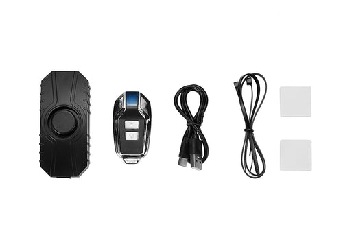
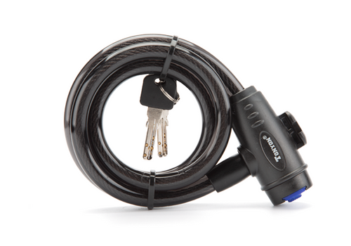
Park away from gates, road centers, intersections, and blind corners. Lock the frame and secure the battery, display, bags, rack, tools, and straps before walking away.

What Type of E-Bike Fits These Destinations?
The best configuration depends on the most difficult part of the route.
|
Destination |
Features Worth Prioritizing |
|
Black Hills |
Fat tires, suspension, hydraulic brakes, stable loaded handling |
|
Black Kettle |
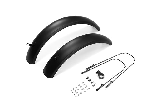
All-terrain tread, smooth low-speed assistance, fenders |
|
White Rock |
Controlled climbing power, useful gears, suspension, strong braking |
|
Little Missouri |
Battery capacity, realistic range, payload capacity, offline navigation |
For forest gravel and rutted roads, prioritize tire grip, suspension, and braking. For steep terrain, look for controlled low-speed assistance, a useful gear range, and dependable downhill braking. For long connecting roads, compare battery capacity, cargo limits, and realistic range rather than maximum advertised mileage.
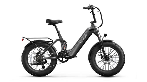
Puckipuppy Hunting E-Bikes include fat-tire, full-suspension, and long-range options that can be compared according to terrain, equipment weight, mounting preferences, and trip distance. The bike still needs to meet the vehicle rules shown on the selected agency map.
Hunting Trip Checklist
- Confirm the hunting unit, season, license, legal method, and species regulations.
- Match the access road to the current MVUM or official travel-management map.
- Verify the permitted vehicle type, seasonal status, registration, and permit requirements.
- Calculate the complete round-trip distance and keep a battery reserve.
- Check terrain, elevation, weather, campground access, fire restrictions, and road closures.
- Park the e-bike before the legal motorized route ends and continue on foot only where access is permitted.
Confirm the Route Before Choosing the Bike
Once the legal hunting unit, motorized access route, and full travel distance are confirmed, choose an e-bike configuration that matches the terrain, cargo load, and expected riding conditions.
🚲Explore Puckipuppy Hunting E-Bikes to compare fat tires, suspension, payload, and long-range options for your next hunting trip.
Related Reading :Best All-Terrain Fat Tire Electric Bike for Hunting